
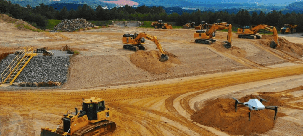
Construction Site Progress Reporting
Aspex Drone Services extends traditional surveying and inspection throughout the entire construction lifecycle, providing detailed visual and spatial insights into project progress. Our aerial progress reports document every stage of development, allowing project managers and stakeholders to see exactly how a site evolves over time.
Using regularly scheduled drone flights—typically bi-weekly, weekly, or monthly—we capture consistent, high-resolution imagery and orthomosaic maps from angles and perspectives that can’t be achieved from ground level. Each flight can be automated and customised to align with contractor workflows, ensuring accurate comparisons, audit trails, and long-term progress documentation.
This data-driven approach supports transparent communication, risk reduction, and evidence-based decision-making, giving construction teams complete visibility across every phase of a project.
“Regular site progress reports offer context and add new dimensions to construction projects. However, it’s difficult to create consistent site imagery over the course of a project. Progress Photos solves this by creating a visual timeline of a project from start to finish. In doing so, it saves costs, keeps stakeholders informed, and addresses safety risks.”
MIKE WINN, CEO OF DRONEDEPLOY

Evaluating Safety Issues
Drones are transforming safety management on construction and industrial sites. Safety managers now use high-resolution aerial imagery to identify hazards, verify compliance, and investigate incidents. In one case, historical drone data revealed a crane had not been properly fastened—information that prevented potential accidents and improved oversight.
These visual datasets open the door to AI- and machine learning–driven safety analytics, where automated image analysis can proactively flag unsafe conditions such as missing barriers, improper rigging, or workers in restricted zones before incidents occur.
Inventory Management
Accurate inventory tracking is critical in industries handling bulk materials such as cement, aggregates, and minerals. One major cement manufacturer operates over 400 facilities across the U.S., each maintaining dynamic stockpiles of ready mix and raw materials. To prevent costly overbuying or shortages, the company conducts monthly drone flights to capture volumetric data on every stockpile.
Using drone photogrammetry, stockpiles are digitally modeled and codified, producing precise tonnage calculations and trend reports. This ensures real-time visibility into inventory levels, optimising supply chain operations and reducing capital waste.
Improving Accuracy and Safety
Traditional stockpile measurement methods—such as manual climbing and tape measurements—are not only dangerous but can yield errors exceeding 200%. Drone-based volumetric analysis eliminates these risks, delivering accurate, repeatable measurements without exposing personnel to hazardous conditions. The result is improved safety, efficiency, and data reliability across all material-handling operations.
Cut and Fill Analysis
In earthworks and civil construction, accurate cut-and-fill estimation determines project profitability. Overestimation inflates bids, while underestimation leads to unrecovered costs and material shortages. Drone-based topographic mapping and volumetric modeling bridge this gap by providing precise surface data for earthmoving calculations.
Using photogrammetry and 3D surface modeling, drones deliver actionable insights on how much material exists, how much must be removed, and where fill is required. This data-driven approach minimises rework, improves bid accuracy, and ensures project margins are protected.
We’re always pleased to provide you with a quote but bear in mind that before we accept any job and sometimes before we can provide an appropriate quote, we may need to ask you some questions. There are many regulations that apply to the operation of RPAS (remotely piloted aircraft systems). we’re required by CASA to ensure that we at all times operate in a manner that is safe and legal.