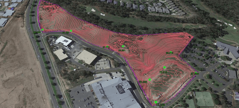
A QLD Drone company was engaged by an international property developer to provide precision contour mapping of a major five star resort development site in Brisbane after access to the site was temporarily denied due to environmental concerns. Contour mapping, including incorporating public survey markers and laying precision ground control points, creating a classified point cloud which excluded local vegetation, and generating a DEM-based contour model of the land, allowed the design process to continue while the environmental concerns were dealt with.

We’re always pleased to provide you with a quote but bear in mind that before we accept any job and sometimes before we can provide an appropriate quote, we may need to ask you some questions. There are many regulations that apply to the operation of RPAS (remotely piloted aircraft systems). we’re required by CASA to ensure that we at all times operate in a manner that is safe and legal.
