Skyspec Drones- Specialists in Solar & Wind Farm and UAV Asset Inspections

Solar Farm Thermography

“Unplanned maintenance costs up to 4x more than planned maintenance.”

Whether it’s unplanned downtime, skills shortages, or the pressure to integrate new technology without blowing the budget, solar operations and maintenance (O&M) is getting harder, not easier.
Many operators know they need to shift from reactive maintenance to proactive strategy—but they’re unsure how to make that leap with limited resources.
At Skyspec Drones, in partnership with Sitemark, we’ve built solutions that take the pressure off internal teams while delivering powerful results—fast.

If you’re losing sleep over your solar asset performance, you’re not alone. But you don’t have to solve everything in-house.

At Skyspec, we help solar farm operators across Australia take control of their maintenance programs—without adding overhead or complexity. With Sitemark’s analytics, we deliver a smarter, simpler way to stay on top of asset health and system performance.

Learn More About Solar Farm Thermography

Wind Turbine Inspections

Data visibility is critical to overcoming reactive maintenance cycles in wind farm maintenance.
Reactive approaches to wind turbines lead to higher costs and reduced energy production.
Data analytics can transform how operations and maintenance teams tackle aging infrastructure in Australia’s wind energy sector.

At Skyspec Drone Services, we provide advanced wind turbine inspections using high-resolution thermal and RGB imaging to ensure the efficiency and longevity of your wind energy assets. Through our partnership with Scopito, we deliver detailed aerial inspections that identify blade defects, structural issues, and thermal anomalies—helping you detect potential failures early and reduce costly downtime. Our drone-based solutions offer a fast, safe, and cost-effective alternative to traditional inspection methods, empowering wind farm operators with precise, data-driven insights for proactive maintenance and optimal performance.

Construction Site Monitoring Solutions with Cutting-Edge UAV Technology

With stakeholders dispersed across the globe, many projects struggle to keep them informed. We’ll provide you with a web interface, with before and after images, videos and orthomosaics. Share the link with stakeholders and keep them up to date with progress in a very professional and impressive way.

With the latest tools and techniques available for drone operators, new construction builds can expect a lot out of drone data collection services. Aerial site inspections and time lapse can show construction site progress like you’ve never seen before. 3D site modeling is available now, and shows the job site in a way that will impress your investors and construction teams alike.

Elevation modeling is also available today in order to see the layout of your latest construction project. Topographic models can also be generated for build sites that offer a challenging landscape. And volumetric measurements are now available to observe the usage of site fill, and more. where required, we deliver centimeter level accuracy using RTK/NTRIP.

Real Estate typically uses drones for images for sales which is important but, the high value work, that is useful to realtor, builder, sub-contractors, project managers and investors, comes from drone time-lapse and internal 360 during construction. Not only can you keep investors informed of progress in a professional and impressive way,  you can also record the locations of all services and other important assets that become invisible when the project is completed.

Infrastructure/Asset Inspections with AI Fully Autonomous Drones


Most drones used for inspections and 3D modelling of infrastructure are standard drones operated somewhat autonomously. They require highly skilled manual intervention to get good results and reduce risk to drone and asset. Skyspec reduces the risk by using a fully autonomous AI driven drone. We can deliver high resolution 3D Models/Digital Twins and high resolution photographs at <1mm resolution and can inspect the most difficult and complex assets. Drone inspections are safer, require little setup time and resources and provide results that can be shared easily with stakeholders. We’re super excited to be able to offer fully automated AI driven 3D scanning using our Skydio 2+ drone and 3D Automation.

Precision Survey-Grade Mapping with RTK Accuracy

At Skyspec Drone Services, we specialize in delivering high-precision aerial mapping solutions tailored to diverse project needs. Utilizing Real-Time Kinematic (RTK) technology in conjunction with Networked Transport of RTCM via Internet Protocol (NTRIP), our drone operations achieve centimeter-level accuracy, significantly reducing the need for ground control points and streamlining field workflows . Our fleet comprises both rotorcraft and fixed-wing drones, enabling us to adapt to various terrains and project scales. Notably, our fixed-wing drones can efficiently survey expansive areas, covering up to 200 hectares per hour, making them ideal for large-scale mapping tasks . For projects requiring certified surveying, we collaborate with licensed surveyors to ensure compliance with all regulatory standards. Whether it’s topographic mapping, volumetric analysis, or infrastructure inspection, Skyspec delivers reliable, high-resolution data to support informed decision-making.

Precision Agricultural Mapping with RTK Accuracy

At Skyspec Drone Services, we offer cutting-edge agricultural mapping solutions designed to enhance precision farming practices. Our drone fleet, equipped with advanced multispectral sensors, captures detailed imagery across various spectral bands, including near-infrared (NIR), red edge, and visible light. This technology enables the generation of high-resolution vegetation indices such as NDVI, providing insights into crop health, soil conditions, and field variability. Through these insights, we deliver accurate field boundary delineations, weed mapping, plant counts and prescription maps that facilitate targeted applications of inputs like fertilizers and pesticides. By identifying specific areas of stress or nutrient deficiency, our services help optimize resource allocation, reduce input costs, and improve overall crop yields. Whether for large-scale farming operations or specialized crop management, Skyspec’s multispectral mapping capabilities support data-driven decisions that promote sustainable and efficient agricultural practices.

Aerial Photography and Video

The real estate market place is already very aware of drone imaging opportunities. Unique views of properties for sale. Video marketing campaigns that help a real estate group provide one of a kind experiences. Property imaging that shows potential buyers the full view of a property from anywhere in the world.

Aerial imaging goes beyond just real estate sales these days. Presenting your business from the air adds some wow factor to your next online marketing campaign.

If you’re looking to show off your B&B, Motorlodge, or Resort, drone photography and videography might be a great addition to your marketing. Consumers make decisions on where to stay based on how the property looks, what’s available, and other customer reactions. A properly placed drone video can encourage more guests to come to your location.

Expert Agricultural Drone Services for Precision Crop Monitoring

Mounted to drones, today’s advanced sensor technology has the ability to capture rich, detailed crop and livestock data. Data farmers, agronomists, and crop insurers can use to solve important problems and make more informed decisions. Data that helps agrochemical and seed companies improve their products, reduce costs, and increase efficiencies.

Today’s drone-based sensors are smaller, lighter, more powerful and often more specialised than previous, aircraft-based versions. They can capture various types of data in high-resolution, helping to make your aerial intelligence efforts easier, safer, and more efficient than ever before.

Elevate Your Projects with SkySpec’s Drone Aerial Inspections and
Agricultural Services

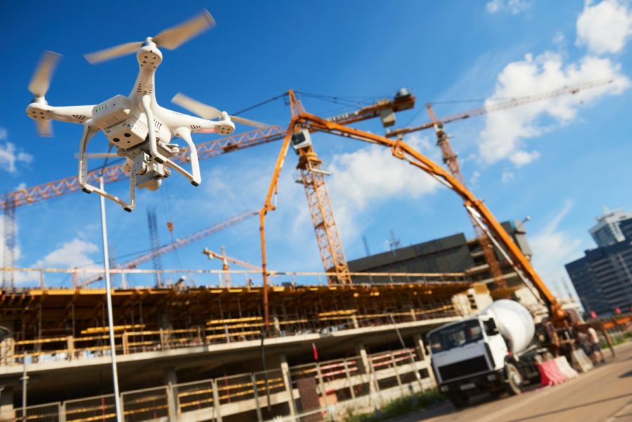
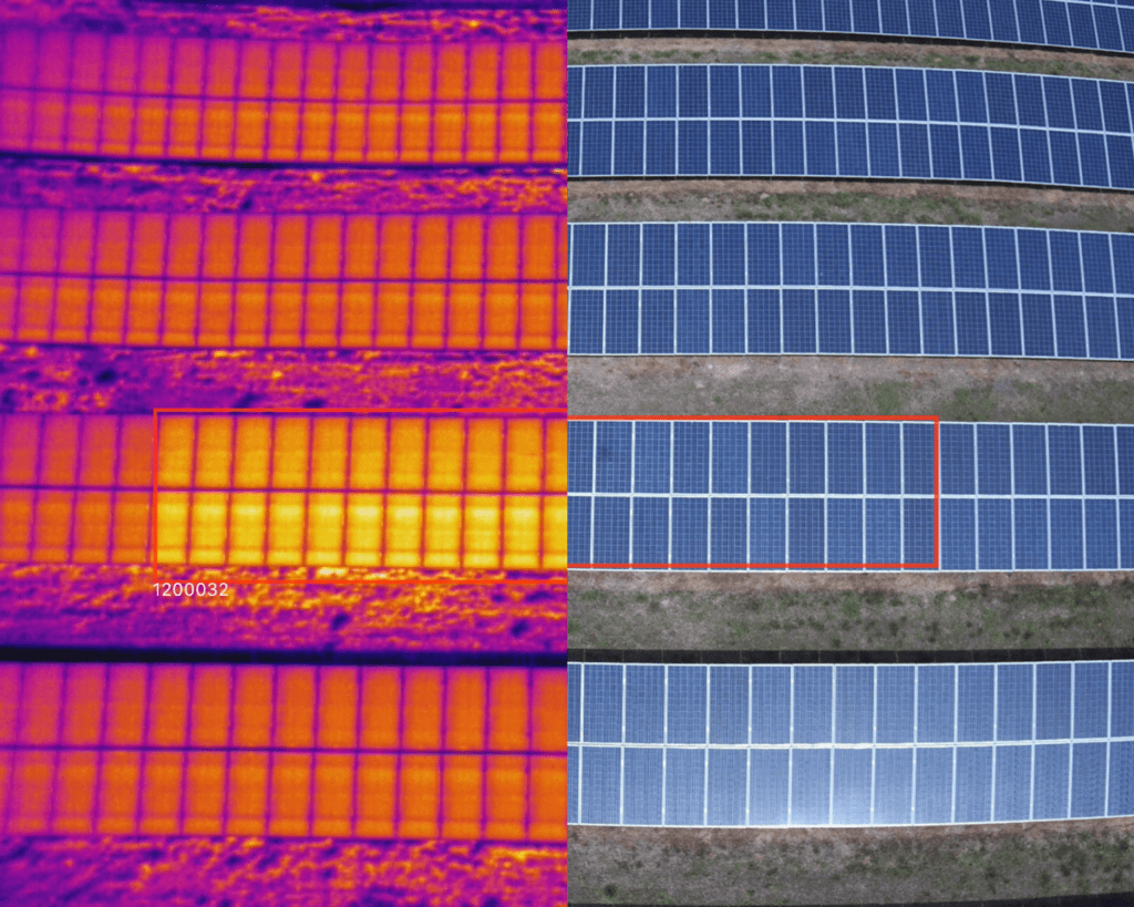
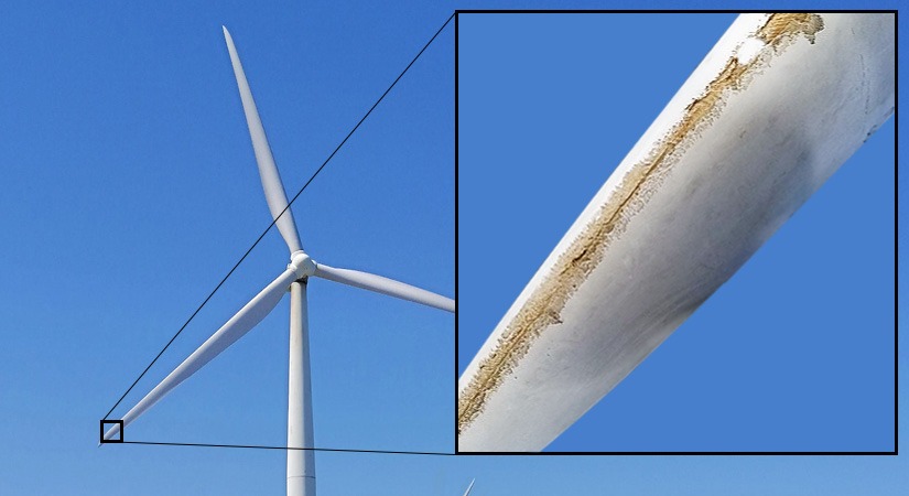
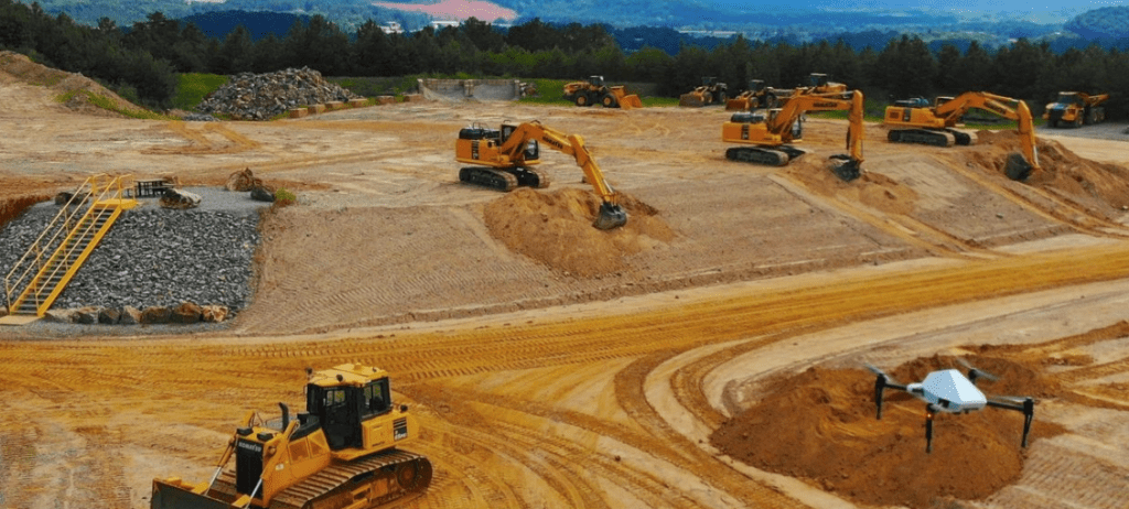
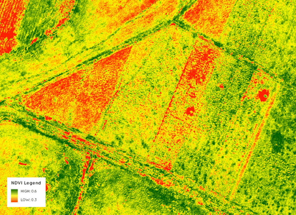
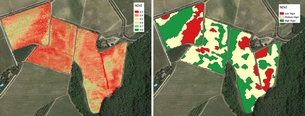
At SkySpec, we specialize in delivering top-tier drone aerial inspections and solutions. In the construction sector, our advanced UAV technology facilitates comprehensive site monitoring, ensuring projects stay on track and stakeholders are kept informed. Our AI driven asset inspection drone can work indoors or outdoors and is capable of detailed inspections at <1mm reolution per pixel and can creat precise 3D models of any structure, allowing models to be imported into autocad. Our agricultural drone services provide precise crop monitoring, enabling farmers to optimize yields and resource usage. With years of experience, SkySpec is the trusted name in drone services for industries ranging from agriculture to construction.

SE QLD, NSW, VIC
Sydney, Hunter Valley, Brisbane, Canberra, Wagga Wagga, Melbourne, Liverpool Plains, Gunnedah, Tamworth, Narrabri, Moree
Phone 0474910403

We’re presently experiencing issues with our VOIP so please call the mobile
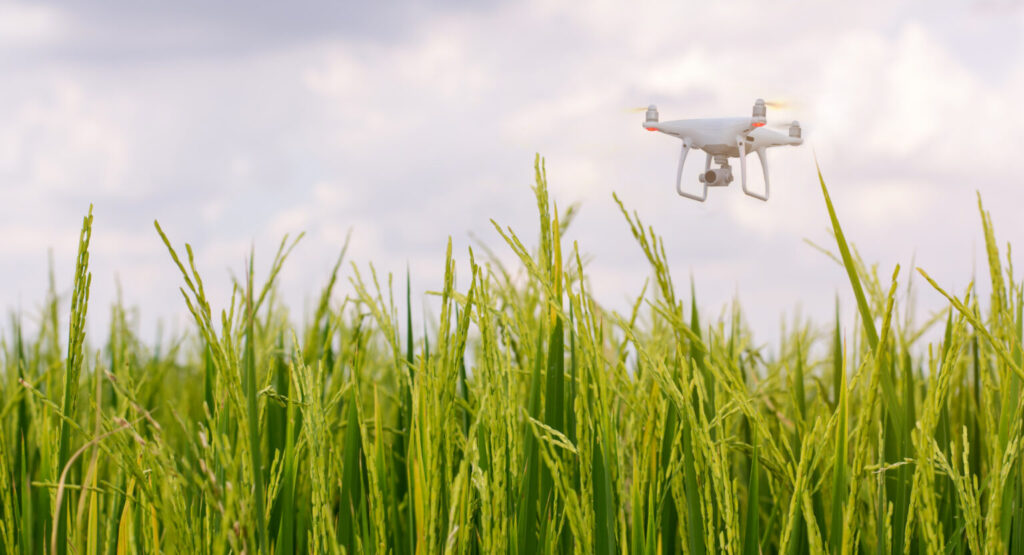
 

1388 Bridgman Road, Mt Olive NSW 2330.

Phone 0455155798